Punjab floods are limited to swampy and muddy earth strips that sit next to rivers, also more technically known, such as riverside areas or katcha.
“In the areas of Katcha, each house has its own boat, every year the same type of flood situation occurs,” said a local resident. So far no damage to the established areas has been reported.
The Kacha area in Pakistan refers to the river settlements established along the Indo River. These settlements cover from Kot Mithan in southern Punjab to coastal areas in Thatta in Sindh. These areas, year after year, face floods from medium to high level. This year, they are drowning once more.
The Katcha areas in Layyah, Kot Addu, Taunsa Sharif, Dera Ghazi Khan and Rajanpur are among the most affected. Thousands of people residing in river settlements have been evacuated to safer areas. According to the flood control room, the floods have devastated river settlements and the flood continues in Rajanpur.
The water flow in Kot Mithan Point on the Indo River has reached 490,000 CUSECs. The water has entered settlements on the banks of the river and remains there, and people are forced to evacuate in ships.
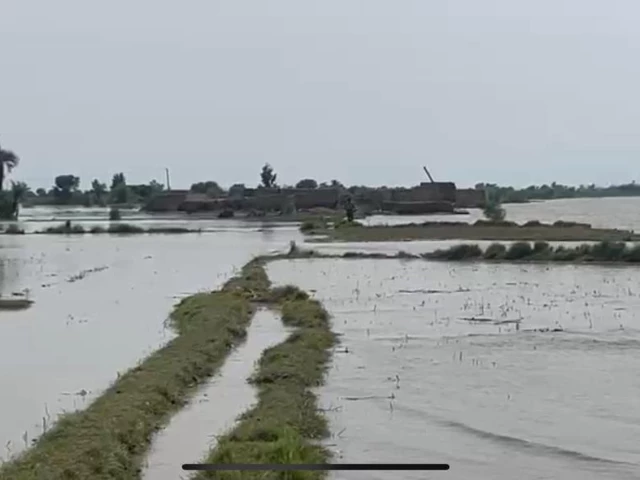
In the areas of Dera Ghazi Khan and Taunsa Sharif, there are medium level floods and flood has penetrated dozens of settlements, such as Ghat and Darahma, along the Indo River.
However, the water level seems to be in decline in areas such as Taunsa Sharif, with 500,000 CUSECs now to 360,000 Cusec. Rescue missions continue to evacuate people and many residents have migrated.
Taunsa Sharif suffers particularly, and our correspondents report that despite the fact that the water level of the Indo River has decreased, link roads still remain submerged. The locals report a strong decrease in the standard of living, since there have been no arrangements for drainage in the affected areas. Taunsa residents have complained about a severe stench that has involved the areas affected by floods, and expressed fear of diseases such as moisture and suffocation wrapped to the district.
In Muzzaffarh, the mosques are making ads on behalf of the 1122 rescue, warning people of possible floods in the Chenab River. The evacuations of low areas near the Chenab River are underway.
20 Tehsil Karor Lal Esan, Tehsil Layyah and Kot Sultan in Layyah are flooded. According to reports, hundreds of acres of crops, roads, schools, mosques and houses are destroyed, all swept by the river. Layyah faces a similar scarcity fight, since link roads are drowning in flood water. “The houses have been demolished, people are starving, nobody has helped,” said an affected resident from Layyah.
The River Sutlej is experiencing a continuous increase in the water level, causing floods of medium level of settlements in the river. It is reported that water has flooded dozens of settlements such as Mauza Mero Baloch, Mauza Jatera, Mauza Noon and Mauza Saldira.
Those affected by the flood of Vehari have declared that crops of thousands of acres have been destroyed, and that the fodder for the animals is over. Those affected fear a high level flood due to the increase in water levels, while administration arrangements seem to be insufficient.
There are high level floods in the head Ganda, Bahawalpur. The water level is 21.10 feet and the output flow is 133,770 cusecs. Middle level floods have been observed in the Sulemanki head, where water entry is 94,143 CUSECs.
The flood prognosis division (FFD) and the Federal Flood Commission (FFC) warned that the Chenab and Indo rivers can reach high levels of flood within 24 hours, while the Sutlej in Ganda Singh Wala will continue at high levels for several days, depending on Indian reservations.
India, according to the Indo Water Treaty, alerted Pakistan about a high -level potential flood on the Tawi river near Jammu on Sunday. According to the FFD, flood floods are expected in Guddu, Sukkur and Sulemanki.