.
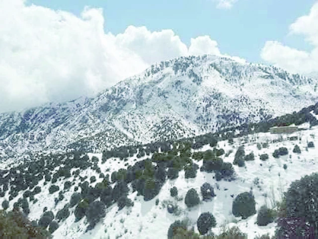
The first snowfall and rain of the winter season was recorded in several mountainous areas of Khyber-Pakhtunkhwa on Tuesday.
ISLAMABAD:
Pakistan is heading into a new active winter phase as a new westerly weather system prepares to enter the country, bringing widespread rain, thunderstorms and snowfall across much of the north and plains over the next few days.
According to the Pakistan Meteorological Department, a shallow westerly wave is likely to approach the upper parts of the country from the afternoon of January 16 and persist until January 19.
The system is expected to intensify from January 20 and extend to most regions of the country from January 21.
The Met Office has warned that heavy snowfall may lead to slippery conditions and possible road closures in Naran, Kaghan, Dir, Swat, Kalam, Chitral, Kohistan, Mansehra, Abbottabad, Shangla, Astore, Hunza, Skardu, Murree, Galliyat, Neelum Valley, Bagh, Poonch, Haveli, Quetta, Ziarat, Chaman, Pishin, Qilla Abdullah, Qilla Saifullah, Noshki, Harnai and Zhob from the night of January 21 to 23. There is also a risk of landslides and avalanches in the mountainous areas of upper Khyber Pakhtunkhwa, Gilgit-Baltistan and Kashmir.
Tourists have been advised to be extremely cautious and avoid unnecessary travel during the planned period.
The department noted that foggy conditions over Punjab, Khyber Pakhtunkhwa and upper Sindh are likely to ease during the wet spell, while daytime temperatures are expected to drop significantly in many regions.
The Met Office said it will continue to monitor the system and will issue updates as the situation develops.